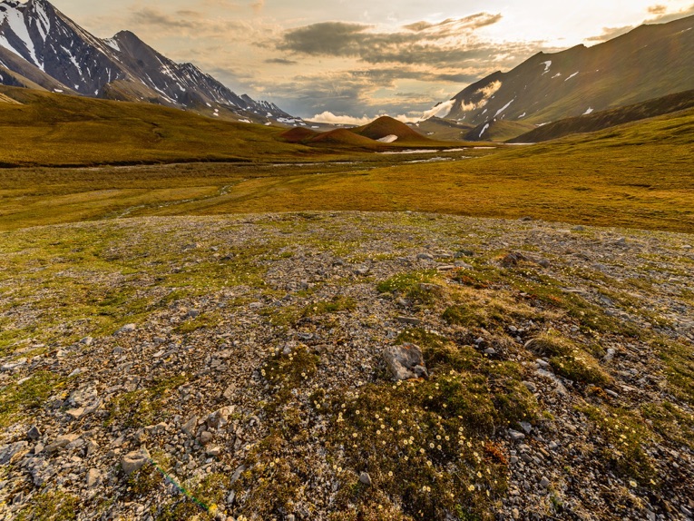
June 2017: Five years after our drive up the Dempster Highway in Canada, we took another long road trip from home to beyond the Arctic Circle. This time we turned west at Whitehorse to Alaska and the North Slope. There, bush plane flights brought us to remote camp sites in the Alaska National Wildlife Refuge (ANWR) and over some of the most amazing land forms we have ever seen. We camped in tundra flower gardens, watching caribou move slowly by. Our ANWR trip was set up by Arctic Wild. Bill Mohrwinkel was our supremely knowledgeable guide. We rendezvoused with Matt Thoft of Silvertip Aviation, our super pilot, at Happy Valley Airstrip, way up the Haul Road (Dalton Highway), which follows the Trans-Alaska Pipeline. On the way there and back we stayed at the Toolik Field Station.
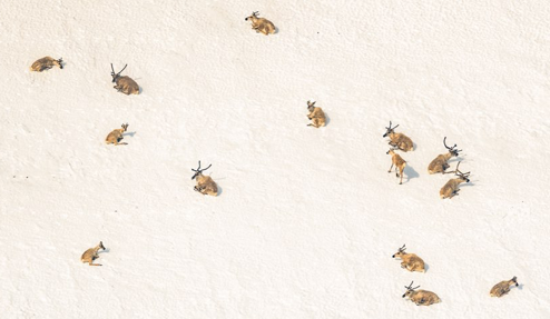
Despite the glorious wildness of the North Slope in the ANWR, the possibility of oil extraction from the coastal plain in the so called “1002 area” is now very real. Opening “the non-wilderness 1002 area” as Sen. Murkowski refers to it, to oil exploration is a feature of the final GOP tax bill. The Trump administration is hurriedly clearing the way for oil exploration in the ANWR. The huge (maybe 10,000 strong) caribou herd we photographed was just at the south edge of the 1002 area. This is the calving ground of the famous Porcupine Herd, often overlapping the Central Herd. The caribou had started to congregate, their "post-calving aggregation" defense against the hatch-out of uncountable mosquitoes and botflies.
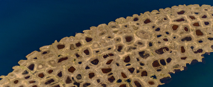
Some of the photos show the relatively neat but extensive facilities of the Prudhoe Bay Oil Field and the extraordinary patterned ground, thaw lakes, and caribou in its vicinity and, just to the west, in the massive still “unused” National Petroleum Reserve-Alaska (NPRA), which the Trump administration has also ordered opened on a fast-track.
In this area the sun never sets during this summer solstice period. From about 930 PM local time (AKDT) to 8 AM it is below 13° and provides the special light that photographers crave with shadow ratios above 4. Times in the captions are Universal Time, Zulu (Z), 8 hours ahead of AKDT. Sun is lowest at ~0145 AKDT (0945 Z) at our ANWR campsites. Slide GPS locations link to Google satellite maps.
Our Feature in High Country News: “An unfrozen North: The world’s permafrost holds vast stores of carbon. What happens when it thaws?”